
New generations of wireless mobile networks are deployed in higher gigahertz frequencies close to sub-millimeter waves. Most popular frequency band for 5G networks is 3.5 GHz, but there are plans for 26 or 28 GHz bands and upper. Higher radio frequencies impose propagation problems especially in dense urban areas due to diffraction. Estimation of diffraction loss is essential in wireless network planning and optimization, where detailed building data is available. In the past, a raster-based building rooftop height data extracted from building footprints has been used down to 1 meter resolution [1]. For numerical evaluation of diffraction loss in case of raster-based input data, fast approximate algorithms are used such as XDraw and its various implementations [2]. Currently vector-based 3D city models with high level of detail attract a lot of interest. However, the analysis algorithms with vector data are slow and there are no efficient fast methods.
The aim of this work is to create fast numerical diffraction algorithm working with high accuracy vectorial 3D building data. This should allow to achieve higher precision of path loss predictions compared to raster-based calculations. In the proposed model, diffraction loss is estimated according to ITU-R P.526-15 recommendation model [3]. The method is based on finding clearance distance between the highest obstacle along the radio wave path and radio beam center-line. The clearance is used for estimating Fresnel diffraction integral giving diffraction loss due to obstructed path. This diffraction loss can be further combined with empirical drive-test calibrated propagation models such as Hata-type models.
The proposed algorithm is built on the principles of XDraw approach, but takes as input vector building data. It behaves as $O(N^2)$ over time by analyzing propagation in rings starting at antenna location and progressing towards the edges of analysis area. The analysis area is divided into square matrix of points and each point is visited only once. For each point detailed geometric analysis is performed to find radio ray intersection with existing buildings and in addition reusing the diffraction results from previously visited points closer to antenna. Two approaches are proposed for approximations of previously calculated points: maximum obstacle and maximum roof diffraction loss. The maximum obstacle method retracts the spatial grid location with maximum diffraction loss from the previously visited points and recalculates diffraction. The maximum roof diffraction method takes into account limited number of first dominant roof plane diffraction calculations. The first method is more accurate, but the second method is faster.
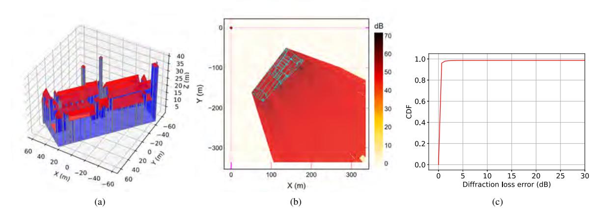
In this work, Amsterdam city 3D building data reconstructed from two-dimensional building footprints and LIDAR data is used [4]. Example of 3D building data is shown by polygons representing walls and roofs in Fig. 1a. The diffraction loss raster calculated from antenna located at zero coordinates is given in Fig. 1b and the difference between exact diffraction algorithms and XDraw implementation is illustrated in Fig. 1c. There are only few percents of coverage points with diffraction error extending above 5 dB.