
Global climate change creates unprecedented local consequences the world over and in Europe as well. The problem makes meteorologists turn from discussions to deep research and take action to combat this problem. The recurrence of heat waves and powerful summer storms have a significant influence on the weather situation in the Baltic region as well (Fig. 1). The main purpose of this presentation is a quantitative analysis along with qualitative study of two hazardous meteorological phenomena in Lithuania – very large hail (hailstone diameter ≥20 mm) and strong tornados (wind gusts ≥28 m/s). According to national criteria for severe weather, they are considered as disastrous meteorological phenomenon potentially devastating for aviation, agriculture and constructions. All data since 1962 have been collected from archives of Lithuanian Hydrometeorological Service.
During the long 58 years period 86 cases of very large hail have been registered in 123 places and 27 tornados cases in 33 places of the country. In fact, about 1 tornado per 2 years and ~2 large hail cases per year registered in the country. Considering to their locality, the real number of occurrences is higher than the observed figure. However due to new technology the information on these phenomena is more and more frequent and exact nowadays. The question, if the density of population influences the number of cases observed, could be rose up as well.
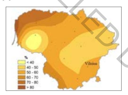
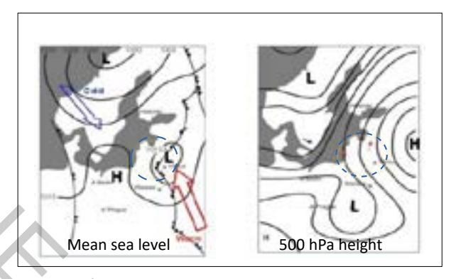
In most cases, especially intense convection develops in situation when cold front from the western or southwestern part of Lithuania approaches the eastern one which is more frequently occupied by hot and wet tropical air mass (50 % of tornados and 40% of hail cases, Fig. 2). In some events mesocyclones develop and they could be detected on radar reflective image as a "hook echo" – it shows the initial stage of mesocyclone that is in tornadic mode. Later this „hook" could be seen as this supercell is in great rotation and tornado occurs. Usage of special meteorological satellite product "sandwich" helps to monitor the development of mesoscale convective system. The convergence at the surface and strong upward of hot and humidit air masss in these mesocyclones associated with divergence at cold dry higher levels is the main reason of powerful discharge of the energy of instability. Obviously, the S/SW/SE flows dominate in 44% of hail and 55 % of tornado cases. The increment of days with tropical air mass in northern countries could be attributed to climate change.
Over 70% cases of large hail occur due to the passage of atmospheric fronts and 61% of these fronts move in deep cyclonic lows. In contrary, there exists a distinction between two basic synoptic situations leading to the development of tornados: the lines of convergence/instability in the tropical air mass (close to 50 % of cases) and the areas of mesoscale convective systems which develop on cold-front wave tops (~30% of all tornadoes cases) and only 3 tornadoes cases were associated with front of occlusion.
Detection of climate change impact on severe weather events in Lithuania is an additional purpose of this paper. The influence of the North Atlantic Oscilliation (NAO) on disastrous meteorological phenomenon has been analyzed and results will be presented. Data have been taken from NOAA's Climate Prediction Center (USA).
The poster demonstrates both phenomena using the charts of distribution over Lithuania, diagrams and histograms as well as impact. Additionally, this paper widely illustrates the distinct spread of very large hail and tornados by daytime and by seasons and the prevailing size of hailstones or wind speed of tornados.